Real-World Use Cases for Geo-Tagging PRO
With built-in geo-tagging features, TagSpaces lets you:
- Save your favorite locations or hidden gems privately
- Plan, document, and visualize trips using photos and notes
- Show vacation images or project photos directly on the map
- Create interactive photo galleries based on geolocation
- Visualize customers, club members, or volunteers by region
- Annotate real estate listings or fieldwork with exact positions
- Add map-based notes for project planning, inspections, or events
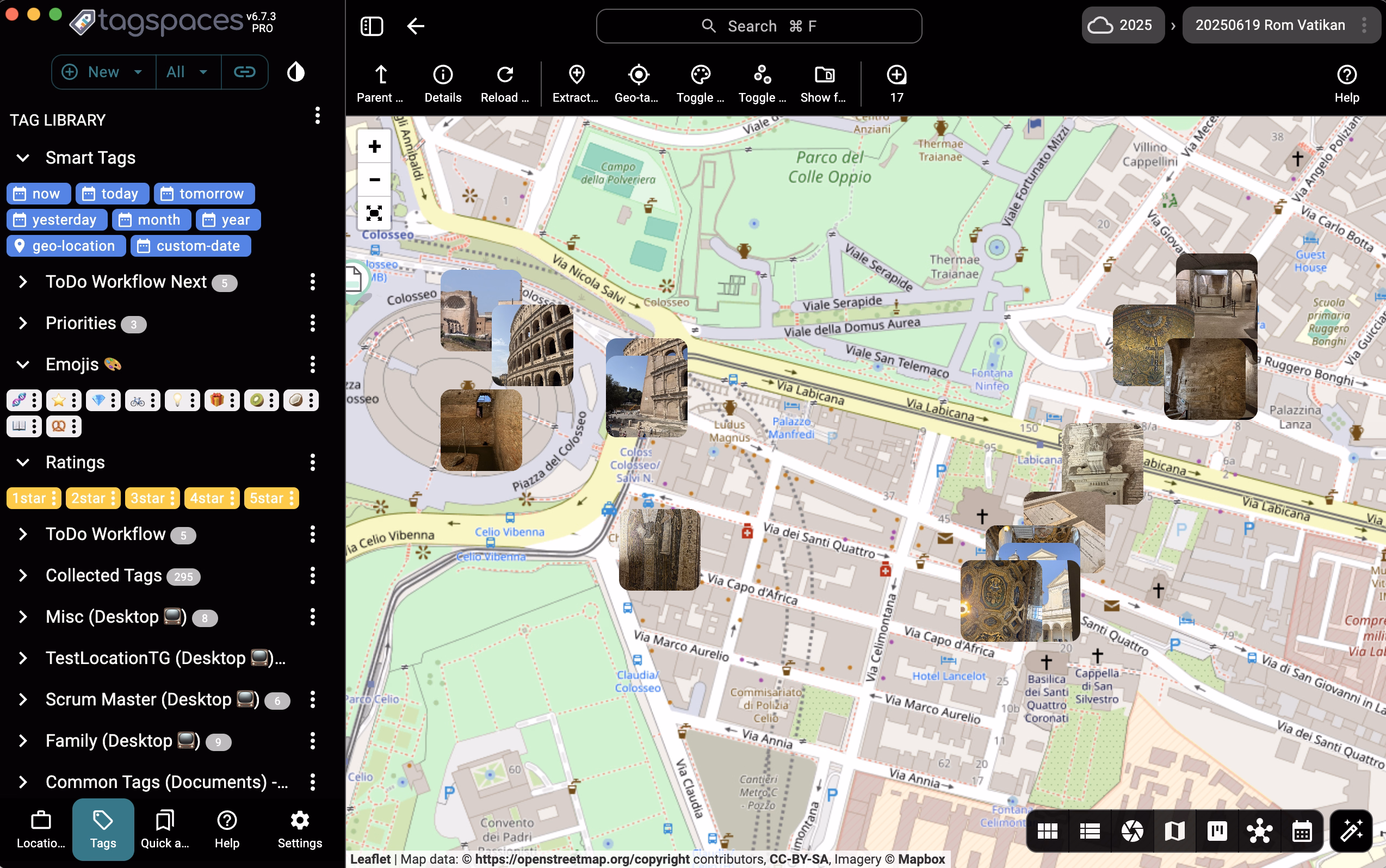
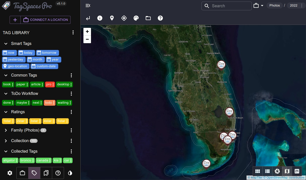
Place Files and Folders on a Map with Mapique PRO
The Mapique perspective in TagSpaces Pro introduces a new way to organize files based on physical location:
- Geo-tags as Plus Codes or MGRS format
- Automatically extract geo coordinates from JPG EXIF data
- Manually tag any file or folder with a geographic location
- Drop pins and manage notes directly on a map
- Navigate through folders using location-based context
- Add geo-tagged notes by clicking directly on the map
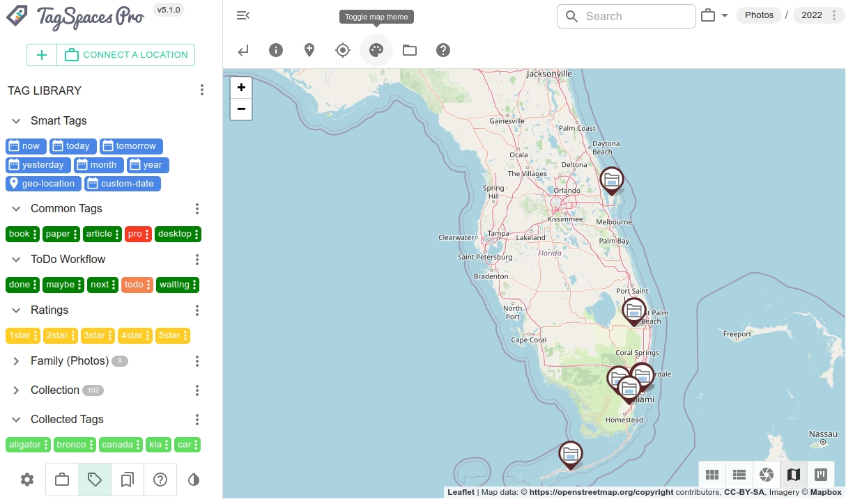
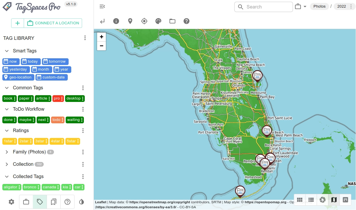
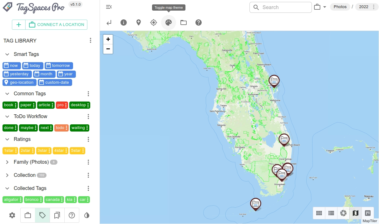
Custom Map Tile Servers for Advanced Users PRO
TagSpaces Pro supports using custom map tile servers. You can switch from the default OpenStreetMap tiles to:
- Topographic maps via OpenTopoMap
- Thematic or styled maps via MapTiler, Mapbox, or other providers
- Satellite tiles for aerial image overlays
Live Demo
Below, you can launch a read-only demo of TagSpaces. It can be opened in a in a separate tab for a full-width browser experience.
Click to load the demo application.